
Route To Nantucket
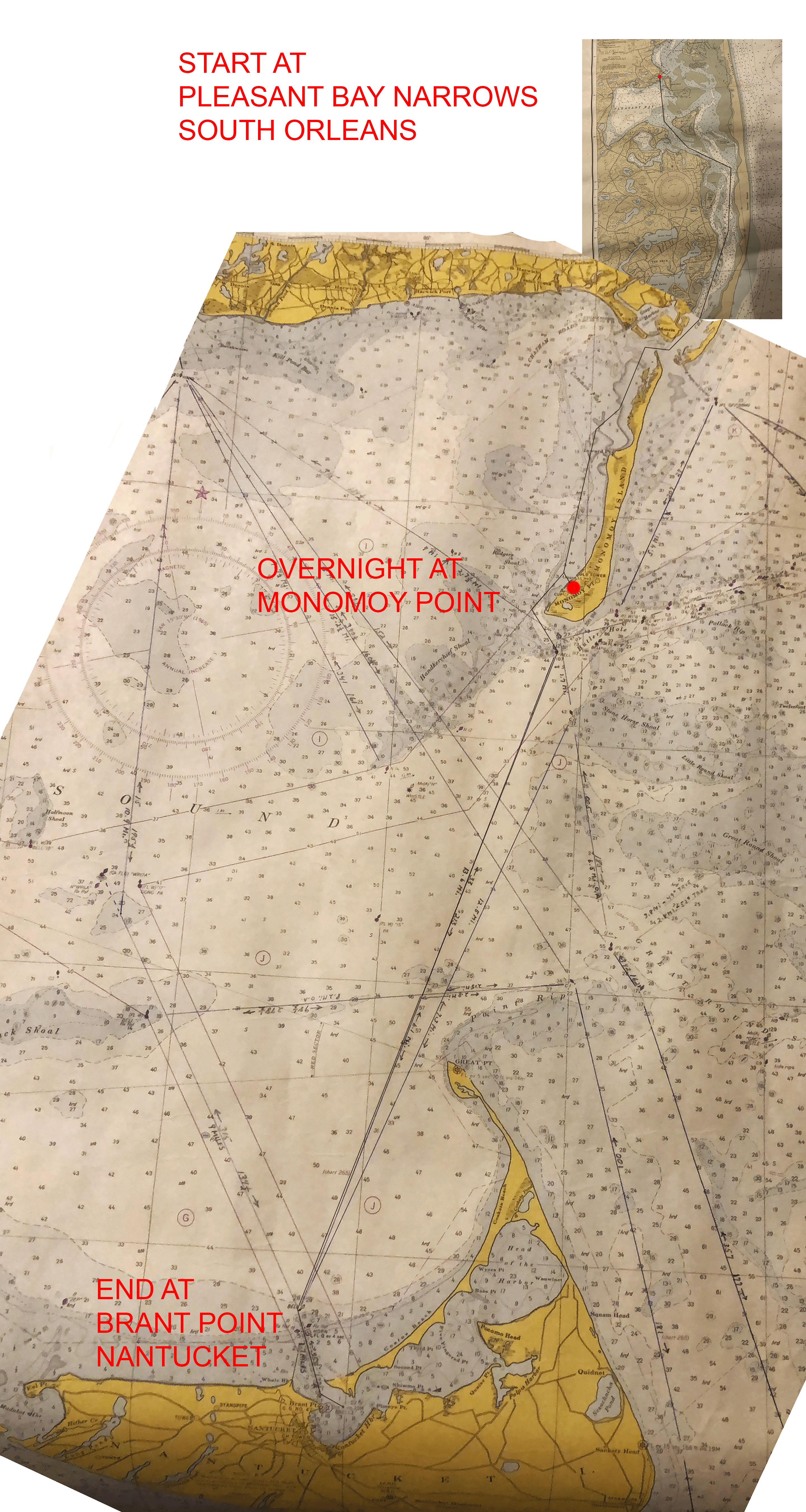
NOTE: No nautical charts for 1954 were available to accurately show the route that was taken, nor could charts of the areas covered be found that were of the same or similar scale.
The two charts used for this page were both made prior to the 1987 "cut-through" (AKA - Chatham Inlet) opposite the Chatham USCG station. The uppermost (much smaller) chart of Pleasant Bay where they began the trip is a 1966 version and the much larger chart of Nantucket Sound and Approaches is a 1961 version.
The route map is far from perfect but the best that could be done with available resources.
